Sunday, September 26, 2010

Castlewood State Park – River Scene Trail (1.5 miles)

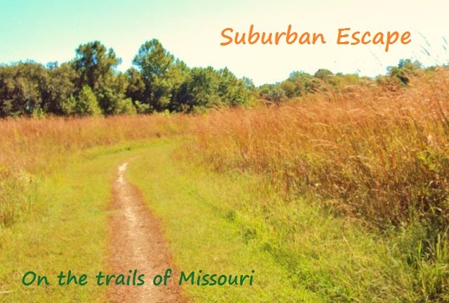
Hiked September 26, 2010

DSC01876

Caitlyn and I spent the afternoon hiking half of the River Scene Trail at Castlewood State Park.  It was a chilly day for early fall, so we were a tad bit underdressed.  However, the trail began with a steep climb up to the top of the bluffs so we warmed up quickDSC01880ly.  We were greeted with a spectacular, panoramic view of the Missouri river.  It was amazing to see so much wilderness; considering we had driven through town to get to the park.  It is quite a hidden gem!  As wDSC01897e hiked high above the river, we had the chance to stop at many lookouts along the way and admire the view.  Below the bluffs was a Union Pacific Railroad track that was very active.  Five trains passed by during the coursDSC01900e of our hike.  The trail had many rocky spots and places where tree roots acted as steps.  I was glad to see that bikers had a separate trail during our hike along the bluffs.  We continued along the upper part of the traiDSC01906l for about half a mile until we came to a set of wooden stair that led us down to the river bottom.  The stairs had a few observation decks built into them. Castlewood State Park used to be the home of resorts and a popular party destination from 1915 to 1940.  We were on the lookout for signs of crumbling buildings when one of the observation decks gave us the perfect opportunity to view tDSC01908he remains of the grand staircase that led partygoers to the resorts.  At the end of the staircase (it was a rather long staircase), we turned left and were greeted by a tunnel that led under the railroad tracks.  Caitlyn enjoyed testing the echo effects of the tunnel.  About a minute after we passed through the tunnel we heard a train coming.  I ran back toward the tunnel to capture a picture of a  train paDSC01909ssing over the tunnel we had just walked through.  I haven’t been that close to a moving train since I was a little girl.  It was awesome!  And loud!  After the tunnel, the trail turned left and we followed along the banks of the Missouri River.  It had been raining that morning, so we had a lot of mud puddles to skirtDSC01912.  We also had to move out of the way for bikers, since we had to share that part of the trail with them.   Though the views from the bottom part of the trail weren’t as spectacular, the recent rains and general moist environment of the river bottomland gave us manyDSC01918 chances to see different types of mushrooms growing on fallen trees and stumps.

Overall, I really enjoyed this hike and Caitlyn did, too.  The views from the upper part of the trail were awesome and the lower part of the trail had plenty of plant and fungi species to keep us entertained. 


Friday, September 17, 2010

Klondike Park – Hogsback Trail (1.5 miles)

Map picture

Hiked September 12, 2010DSC01700

  Klondike Park is one of my favorite parks in St. Charles.  I’ve hiked and camped there, and I discover something new every time.   The pDSC01706ark boasts many diverse trails; from trails that wind over glittering sand and beneath bluffs to wooded trails high above the Missouri river.

The Hogsback Trail is a wooded trail with awesome  views of the Missouri River.  We began our hike by climbing the paved path past the Conference Center and up to the overlook.  The overlook areaDSC01708 provides great views of the  Missouri River.  You can see sandbars and bottomland fields.  There is also a display of how the river looked when Lewis and Clark camped along the riDSC01714ver’s edge. 

From the overlook, we found the trailhead for Hogsback Trail.  It began in the woods with overlooks of the river below.  A wooden fence lined the trail to prevent hikers from falling below.  At one spot, we were right above the Katy Trail and had spectacular views of the Missouri River.  This part of the trail was lined with DSC01736 tall cedars.

After a while, we came to a switchback in the trail that began a descent down the bluff.  There were several switchbacks during this part of the hike.  At times, the trail became very narrow and slanted, so we had to make sure the kids stayed on the higher part of the trail; away from bluff edges.  Again, they had fun  DSC01722 asking, “What if you fell down THERE!?”  There were rock outcrops to explore along the  trail.  After a while, we  came to a tall, mossy rock  wall.  ThDSC01731e trail meandered past the rock wall and back into the woods.   There were a variety of pretty wildflowers that made me wish I knew what they were.  We also viewed many orb weaver webs in the trees that glistened in the sunlight.  At one point, as Scott was walking, he ran  intDSC01745o something dropping down from a web.  It landed on the ground and we inspected it.  I had to look up what it was.   Turns out, it was a Banded Tussock Moth Caterpillar  (not to beDSC01733 confused with a Yorkshire Terrier).  Other than a toad, some spiders and the caterpillar, we didn’t see much wildlife on the trail.   However, the trees, flowers and ground cover were pretty cool.  I took a picture of some orange mushrooms because I had never seen orange mushrooms before.  I tried to identify them by searching online and I believe thDSC01737ey were Orange Mycenas.

As we descended lower into the forest, the trail ran perpendicular to highway  94 and we could hearDSC01739 the highway traffic.  It wasn’t too long before the trail ended along the main road in Klondike Park.  So, we had to hike along the rode back to the parking lot.

DSC01726 Overall, I really enjoyed this trail.  Abraham fussed a bit and the kids whined a bit toward the end, but it was another trail that had plenty of views, cool rock outcrops and little  discoveries along the path.  The map of the trail at Klondike Park was a bit confusing.  It wasn’t clear where the trail began and ended and the map was hard to follow when we came to an intersection along the trail.  Having a good sense of direction helped at that junction. 

DSC01771After our hike, we ate lunch in the park and then drove about 3 miles to Augusta and picked apples at Centennial Farms.  It was the perfect ending to our  morDSC01777ning of hiking.

Wednesday, September 15, 2010

Meramec State Park – Natural Wonders Trail (1.3 miles)

Hiked September 6, 2010

DSC01623 After a picnic lunch by the dining hall/general store, we headed off on our second hike of the day; a 1.3 mile trail called Natural Wonders.  It  begDSC01626an by the Visitor Center.  At first, it seemed like it would be just hiking in the woods (which, when you don’t know how to identify different trees or flowers, can get a bit monotonous).  However, the trail livDSC01627ed up to its name.

From the visitor’s center parking lot, a set of steps led us into the woods.  The woods were pretty thick, but the trail was pretty easy.  It wasn’t long before we came upon a spring-fed stream that had water cress growing in it.  The kids enjoyed watching the pond skaters and the fish swimming in the clear water.  I tried to look for DSC01628tadpoles and craw dads, but none were to be found that day.  So, we moved on.  Natural wonders abound!  We found a cave!  This one didn’t look safe to DSC01631explore.

It wasn’t long before we came upon another cave.   Evidently, it had once been open for exploration but was temporarily DSC01634closed to prevent the spread of White-Nose Syndrome, a mysterious fungus of sorts that is rapidly killing bats. 

After more walking through the woods, crossing streams and exploring rocDSC01636k outcrops, we came upon our third cave!  As you can see from the picture, we definitely couldn’t explore this cave.  No  explDSC01645anation was given, but I assume it was either unstable or, again, trying to protect the bat population.  Still, it was so nice  just to stand in front of the cave and cool off for a while.  Caitlyn found some crevices near the cave to explore. 

DSC01647 Toward the end of this hike, the kids were getting tired and a bit whiny, but not too bad.  The possibility of finding another cave kept them on their toes and eager to finish the hike.  It ended with a nice walk through open woods.


Meramec State Park – Walking Fern Trail (.5 mile)

Map picture

Hiked September 6, 2010

Meramec State Park is about three miles off I-44 from Exit 226.  It’s a huge park with many diverse trails.  We decided to hike two trails that day; Walking Fern Trail (.5 mile) and Natural Wonders Trail (1.3 miles), with a break in between for lunch.

Our first stop at the park was at the Visitor Center to use the restrooms, collect maps and tour the (free) nature museum.  It was a really neat museum with explanations of how the park was developed by the CCC and exhibits of plant and animal life found in the park and artifacts left by Native Americans.

DSC01598Then we drove to the Walking Fern Trailhead to begin our first hike.  Incidentally, our family has a hiking mascot we call “Hikers”.  He’s a little whiDSC01600te bear that came with Abraham’s baby carrier (a Deuter Kid Comfort II Child Carrier) and he likes to get out and explore with us. He hung in the pack during ourDSC01601 hike at Indian Camp Creek Park, but he’s more adventurous now. 

Walking Fern Trail is a short trail, but it packs a BIG puDSC01602nch!  We hiked the trail clockwise; beginning with climbing steps and hiking a trail path high in the woods.   The height of the trail afforded us some nice views of DSC01605  forest below.  The kids liked to ask each other, “What if you fell down THERE?!”   The kids had to watch out for roots along the trail that could pose a tripping  problem, but otherwise, it was pretty easy terrain.  It turns out, we were walking on tall bluffs and above caves.  Eventually, we descended  some stairs to the marshy floor below.  We explored rock outcrops andDSC01612 mossy bluffs.  Scott even climbed up one of the bluffs.  We had read in our 60 Hikes within 60 Miles (St. Louis) book that there was a cave along the trail that the kids could explore, so we kept our eyes open for it.  About 3/4 of the way into our hike we were rewarded by finding a set of stairs that led up to the cave.  It twas a great spot to stop and rest.  Caitlyn and I expDSC01615lored the cave with a tiny, keychain flashlight.  It was about 20-30 ft deep and the floor was pretty muddy.  The flashlight didn’t illuminate the cave all at  onceDSC01616, so it was a bit eerie trying to make out what the big lumps were in the back of the cave before the light hit them.  Turned out, they were just large rocks or lumps of mud.  Hard to say, but at least it wasn’t a bear.  :)  There were no bats or cave crickets; nothing but mud, but it was still fun to do some exploring off the beaten path.  After we finished in the cave, it was a short hike through the woods to the parking lot.  I think this was a great hike to do with the kids.  It was short enough for them not to get tired and packed with enough interesting natural features that they didn’t get bored.

Wednesday, September 8, 2010

Indian Camp Creek Park

Map picture

Hiked on Sept. 5, 2010

Indian Camp Creek Park is in Foristell, MO off Dietrich Rd.  It’s a      fun park with many shelters and playgrounds.  We began our hike from shelter #1 on a grass path that meandered through tall prairie grass, Black-eyed Susans and other wildflowers that I couldn’t identify.  It was a cool, but sunny day, so the dragonflies, butterflies and grasshoppers skimmed the tops of the tall grass.  After a few hundred yards, we took the trail to the left which led into the woods.  We were in the woods for a bit, then back in the prairie grass for a bit, and then back into the woods for about a mile and half.  The trail through the woods was fairly easy with a  few moderate climbs and descents.  Overall, I’d say it’s a great trail to walk with young children.  From an adults perspective, it can seem like tree after tree after tree, but hiking with young children causes you to discover little wonders that, otherwise, would go unnoticed.  My only complaint about hiking in this park is that you have to share the trails with horses and bikes.  The horses themselves weren’t a problem, but you have to watch out for what they leave behind (see below).  However, the mountain bikers were a different story.  There are many blind spots in the woods and there were times when a mountain biker was suddenly upon us.  No accidents, but we had to be aware of that possibility.  Still, we had a great time and it was a positive hiking experience for the kids.

DSC01553

Hiking on the prairie. 

DSC01565

Wildflowers.

DSC01557

Walking into the woods.

DSC01572

We saw a lot of these bowl-shaped fungi clinging to the sides of trees.

DSC01570

We saw a lot of this, too. 

DSC01568

An abandoned tree house!

DSC01573  DSC01574

As I mentioned, hiking with young children opens new doors of discovery.  Jacob found millipede on the forest floor.  Caitlyn’s hand is in the first photo to show how big the millipede was!

DSC01580

Love those wooly bears; a common site in the fall!

DSC01575

Abraham worn out from all the hiking.

DSC01581

Caitlyn found a cool hiding place!

DSC01588

Out of the woods and on the last leg of our journey.